Two days ago, the last note of this year's Festival of the Sound faded out of the Charles W. Stockey Centre, closing a three-week run that started July 22. Downtown is doing the thing it does every August 10th: quieting down just enough that you can hear gravel crunch under your own shoes again. If you're one of the people who lives here and walks the waterfront on a normal Tuesday, this week is arguably the best one all summer for it. Fewer cars circling for parking on Bay Street. Fewer strangers stopping to ask which way to the Bobby Orr Hall of Fame. Just the trail.
Here's the thing about that trail, though. Ask five people how long the Rotary and Algonquin Regiment Fitness Trail actually is and you'll get five different answers, and none of them are lying.
The Town of Parry Sound's own page calls it a 6 kilometre waterfront trail. The Ontario Trails Council lists it at 5 kilometres. The Georgian Bay Biosphere Reserve's Amazing Places guide, which is the body that actually certifies the wheelchair-accessible portion, pegs the accessible core at 3.3 kilometres. None of these organizations are wrong. They're describing different pieces of the same corridor, and that mismatch is the most honest fact about this trail you'll find anywhere: most people, including most of the guides written about it, only ever experience about half of it.
A rail bed dressed up as a boardwalk
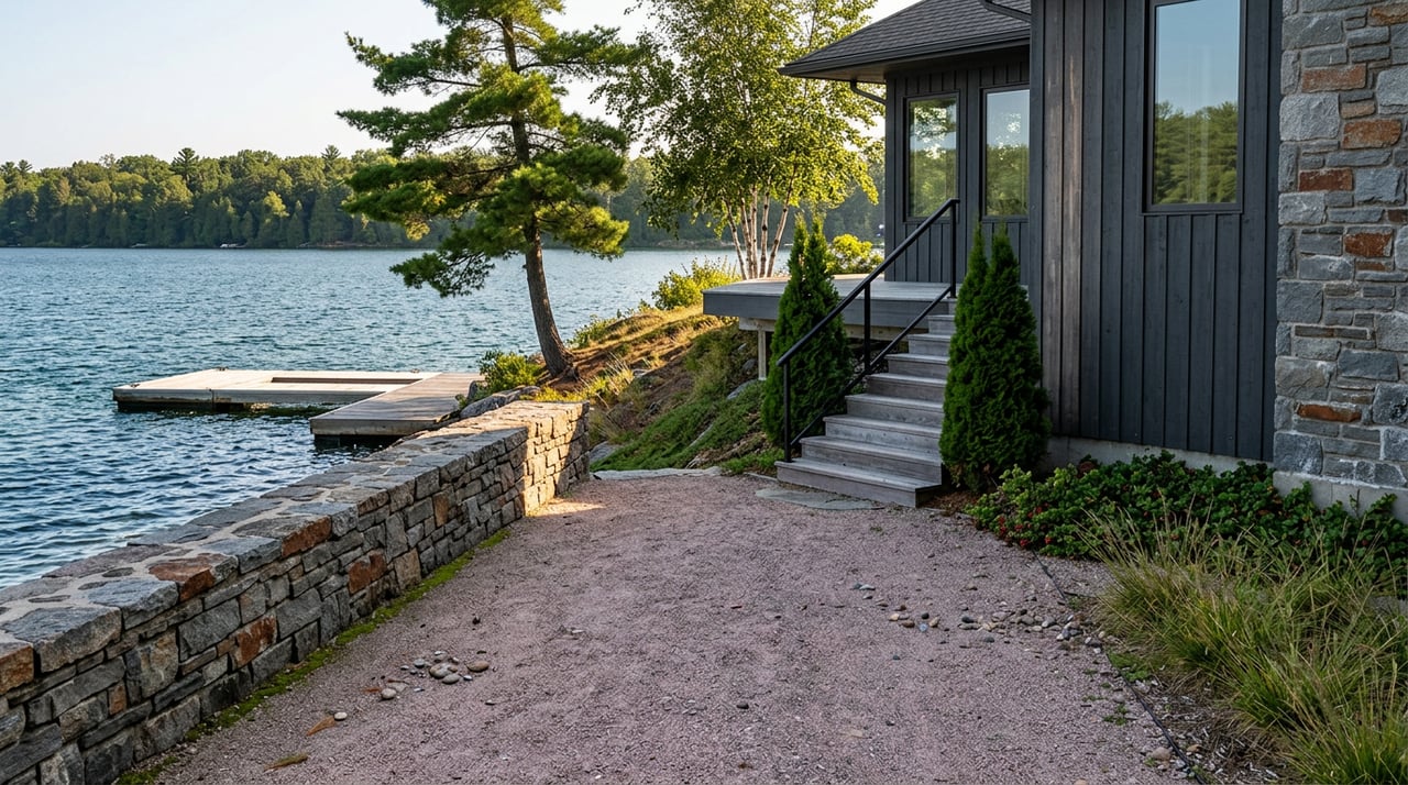
Part of why the trail feels so different depending on where you catch it is that it wasn't built to be a trail at all. It started life as a rail spur for the CN and CP railroads, moving lumber, coal, and eventually oil to storage tanks that once stood around the inner harbour. That spur ran until 1984, when it was decommissioned, the oil tanks came down, and the right-of-way was rehabilitated into the crushed pink granite path that carries walkers, cyclists, and in winter, snowmobiles along the shore today.
That industrial past explains a lot about how the trail behaves. It's why it runs mostly flat and dead straight in sections where the rest of the Canadian Shield around it is anything but. It's why it reads more like infrastructure than wilderness for its first stretch, complete with five fitness stations, benches, and picnic areas. And it's why the town maintains four separate entry points rather than one obvious trailhead: Champagne Street, Bay Street, Prospect Street, and Salt Dock Road, each a legacy of a rail line that once served an entire working harbour rather than a single scenic overlook.
Along the way, interpretive plaques mark the Algonquin Regiment memorial, the Shrine Club monument, and the Rotary monument, a reminder that this stretch of shoreline is Anishinaabeg territory, part of the traditional lands of the Wasauksing First Nation.
Where the write-ups quietly stop
Nearly every online guide to this trail, including three you've probably already read if you searched your way here, describes the same postcard stretch: the pink granite path, the view of the CPR trestle bridge arching over the Seguin River, maybe a stop at Waubuno Beach. That's the 3.3 kilometre accessible core, and it's genuinely the easiest, flattest, most photogenic piece of shoreline in town. It's also where the description usually ends.
Past that point, at the bottom of Salt Dock Road, the trail's personality changes completely. This is where the maintained fitness trail hands off to the North Shore Rugged Trail, a 2.5 kilometre stretch that trades crushed granite for actual granite outcroppings and pebble beach scramble. It's also designated as an off-leash area for dogs, which tells you something about how few people treat it as an extension of the same walk rather than a separate destination. The town's own trail page describes it as simply what it sounds like: rugged. Toward its north end, you'll want to respect the private property signage that starts appearing as the public shoreline allowance narrows.
It's along this quieter half, near where the Seguin empties into Georgian Bay, that lake sturgeon are still occasionally spotted, a species considered threatened that has somehow persisted in the Big Sound long after the industrial waterfront around it disappeared.
The lookout most people save for last, if they get there at all
If you'd rather gain elevation than mileage, the Tower Hill Lookout sits just off the main trail corridor and asks for a 130-step climb up a 30-metre tower. What you get at the top is a genuine 360-degree view of the harbour, one of the only vantage points in town where you can see the trestle bridge, the working boat traffic, and the outer islands in a single turn. It pairs naturally with either half of the trail below, but because it requires a short detour and a staircase, it's the piece most likely to get cut from a quick evening walk. That's exactly why it's worth building in on a week like this one, when nobody's in a rush to beat festival traffic back to a parking spot.
Where the rail line used to end, a brewery starts
If your walk takes you toward the trestle end of the corridor, near where the old spur line crossed the Seguin River, you'll land at Trestle Brewing Company, a craft brewery built on the old train station property with a patio that looks directly up at the trestle bridge. Brewmaster Matt Lyons and his team make their beer with Georgian Bay water as the base, which is either a nice detail or the most on-brand possible way to end a walk along the water, depending on how you look at it. The brewery is open daily from 11am to 9pm, with last kitchen orders 30 minutes before close, and it functions as a genuine community gathering spot rather than a tourist stop that happens to sit on a trail.
There's a small symmetry worth sitting with here. The rail spur that once hauled coal and oil out of this harbour shut down in 1984. Four decades later, the same stretch of shoreline it used to run through is where people gather to drink something made from the water it once ran alongside. Nothing about that required a marketing plan. It's just what happened to the land once it stopped being used for one thing and became available for another.
This particular week
If you're weighing when to actually do the full corridor rather than the usual clipped version, this stretch of August is a genuinely good window. Bands on the Bay continues its run at the Stockey Centre on Tuesday evenings at 7pm, giving you a reason to end an evening walk downtown rather than at the trestle. The festival crowds that filled the accessible core all July are gone. And the second half of the trail, the part almost nobody mentions, is exactly as uncrowded as it always is, just easier to enjoy without dodging the overflow from Bay Street.
Most people who've lived in Parry Sound for years have never walked past the salt pile at the north end of the maintained fitness trail. That's not a criticism. It's just what happens when a corridor gets described in pieces by four different organizations, each certifying the part they're responsible for. The whole thing, from Champagne Street to wherever the rugged trail's private property signs start, is still there for anyone who wants the version the write-ups keep leaving out.
Parry Sound rewards the kind of attention that goes past the first beach, whether that's a longer walk or a longer look at what a piece of waterfront actually is. If you're weighing a move to this stretch of Georgian Bay, or thinking about what a property here is really worth once you understand its access, shoreline, and history the way a local would, the team at Coxworth & Associates spends its time exactly where this trail does: paying attention to the parts everyone else skips past.